 Credit: NASA/JPL-Caltech/MSSS
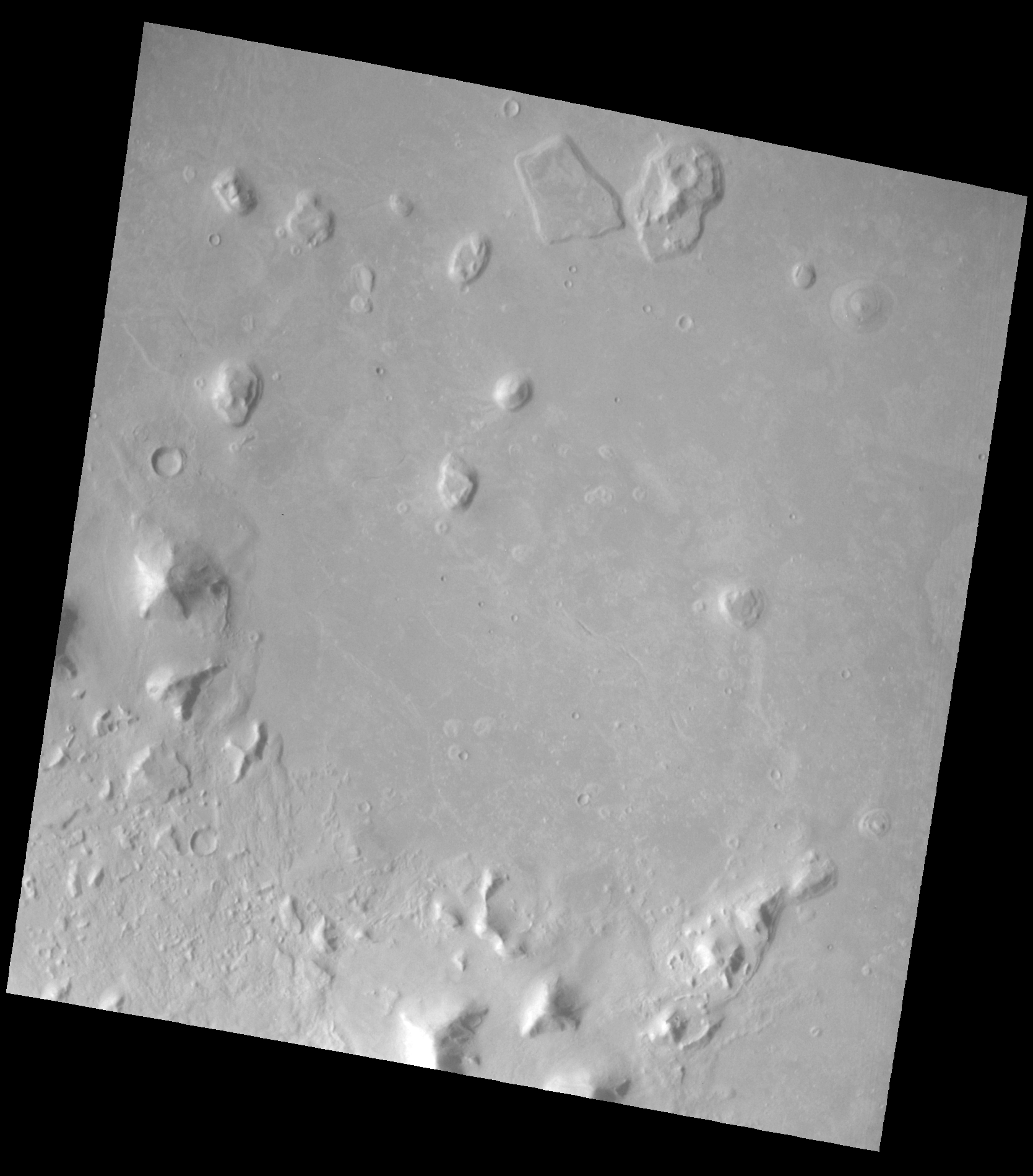
Cydonia is a region on Mars bordering Acidalia Planitia to the north and the Arabia Terra highlands to the south, sitting along the planet's dichotomy boundary, the sharp global transition between the smooth northern lowlands and the older, heavily cratered southern highlands. The region is covered in dozens of mesas, knobs, and buttes, remnants of a once continuous layer of bedrock that has eroded away over billions of years, leaving these isolated formations scattered across the landscape.
Cydonia is best known to the public for a hill formation photographed by the Viking 1 orbiter in 1976, whose lighting and shadow at the time made it resemble a humanoid face. Higher resolution imagery gathered by later missions, including the Mars Global Surveyor in 1998, confirmed the formation as a natural mesa, shaped by the same erosional processes visible throughout the wider region rather than by any kind of construction.
 Credit: NASA/JPL-Caltech/University of Arizona
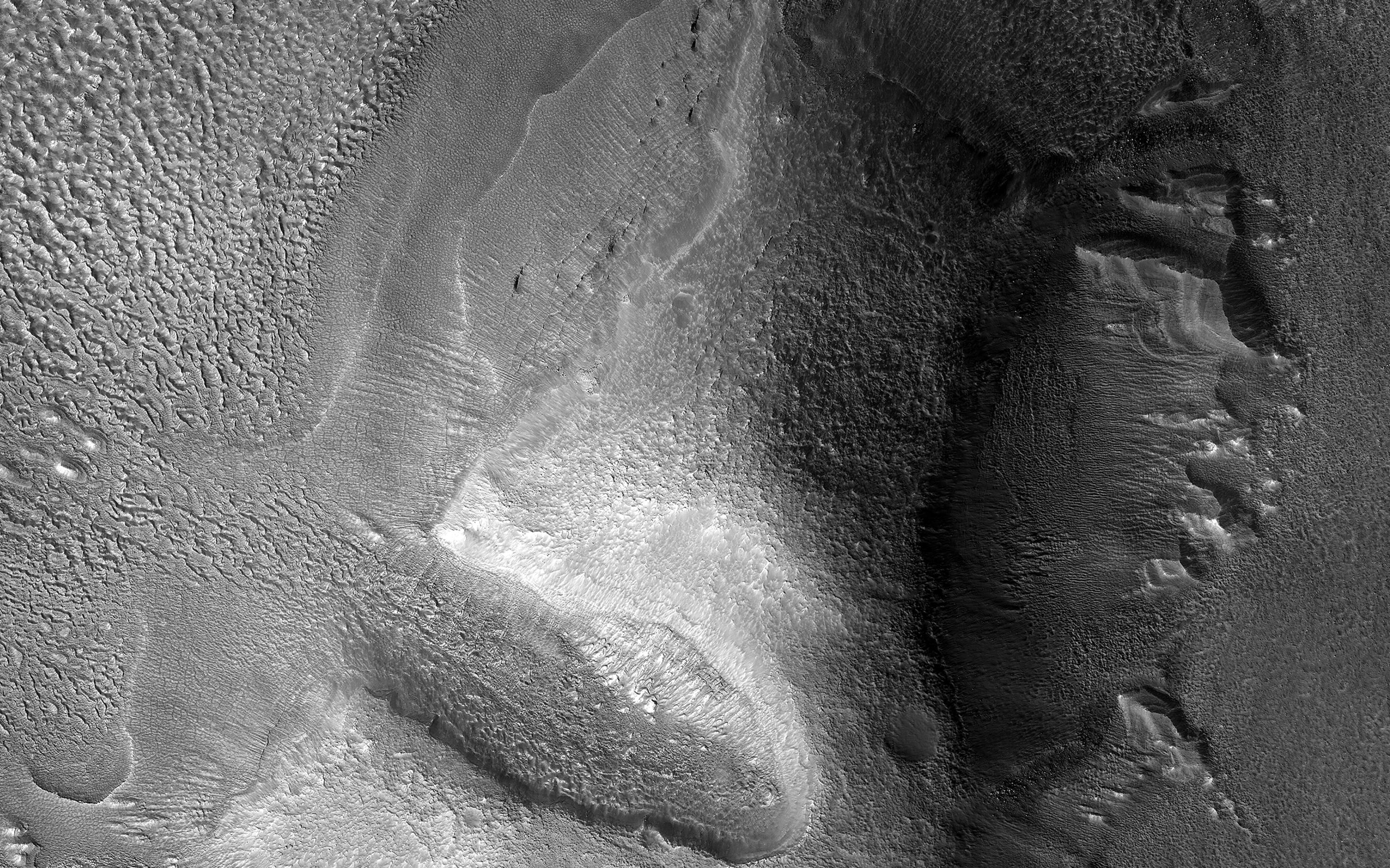
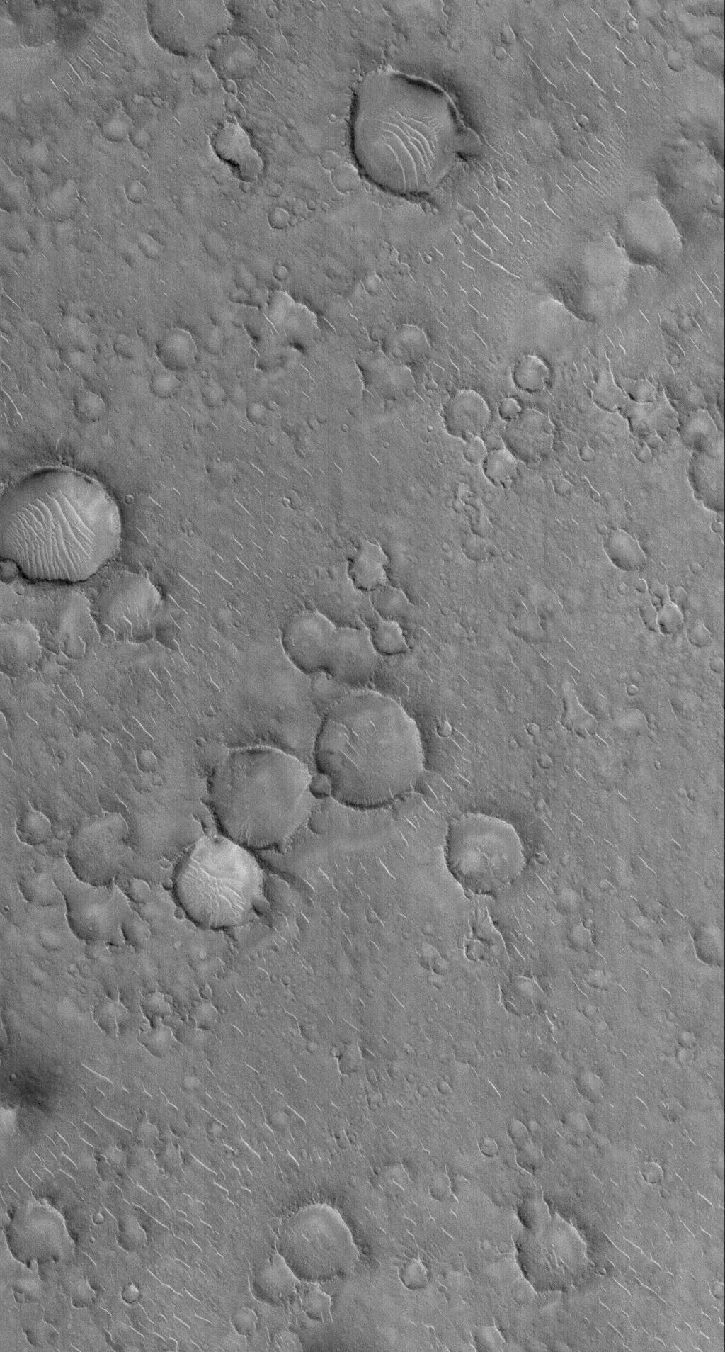
A transitional region along the Martian dichotomy boundary, roughly 400 kilometers east of Cydonia, characterized by dissected plateaus, knobs, and lobate debris aprons. Radar data gathered by the Mars Reconnaissance Orbiter's SHARAD instrument indicates these debris aprons are composed largely of water ice, most likely the remains of debris covered glaciers that have persisted in this mid latitude band for a very long time. The sharp scarps visible along many of these features show where that buried ice has slowly sublimated away, leaving collapsed debris cliffs behind.
 Credit: NASA/JPL/Malin Space Science Systems
One of the largest confirmed impact basins on Mars, roughly 1,500 kilometers across, located southeast of Deuteronilus Mensae on the far side of the planet's northern lowlands. The basin formed from a massive impact around 3.9 billion years ago and has since been partly filled and resurfaced by later volcanic and sedimentary material. Isidis Planitia was the intended landing site of the United Kingdom's Beagle 2 lander in 2003, and more recently NASA's Perseverance rover has examined ancient rock exposed along its western margin, some of the oldest material the mission has studied.
 Credit: NASA/JPL/Arizona State University
A vast, flat, sparsely featured plain in the Martian northern lowlands, directly adjacent to Cydonia and lying roughly opposite Isidis Planitia relative to Deuteronilus Mensae. Small mounds with summit depressions appear scattered across parts of the plain; researchers have proposed these may be cinder cones or pseudocraters formed by the interaction of lava and ice, a feature also observed in Isidis Planitia. Acidalia Planitia is also the setting used for the fictional Mars mission in the novel and film versions of The Martian, though the real plain has never hosted an actual landing.